Farming Autonomy Operating System
Environment Perception & Obstacle Avoidance
Sees what's in the way, and knows when its view is limited
The FAOS watches the path ahead with camera and LiDAR. It spots people, animals and obstacles early, notices when a sensor’s view is degraded, and hands every finding to the part of the system that decides what to do.
How it works
-
01
Zones That Adapt to Speed
Three zones around your machine decide how it reacts. Here it spots a person and an obstacle, slows down as they come into its warning zone and drives around both.
- Perception zone As far as the sensors can see: it shrinks in fog, dust or poor light.
- Warning zone Grows with speed: slow down, drive around.
- Hazard zone Grows with speed: safe stop.
A LiDAR point cloud of a robot in an open field, ringed by a red hazard zone and a dashed orange warning zone, with the camera's view above. It detects a person and an obstacle ahead and shows their distances, slows down as they come into its warning zone, plans a route around both and drives back onto its track. -
02
Zones That Follow the Field
The zones take the shape of the place your machine works in.
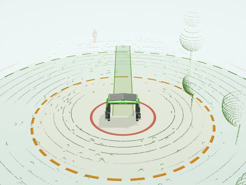
Open field: circles. People and animals can come from any side. 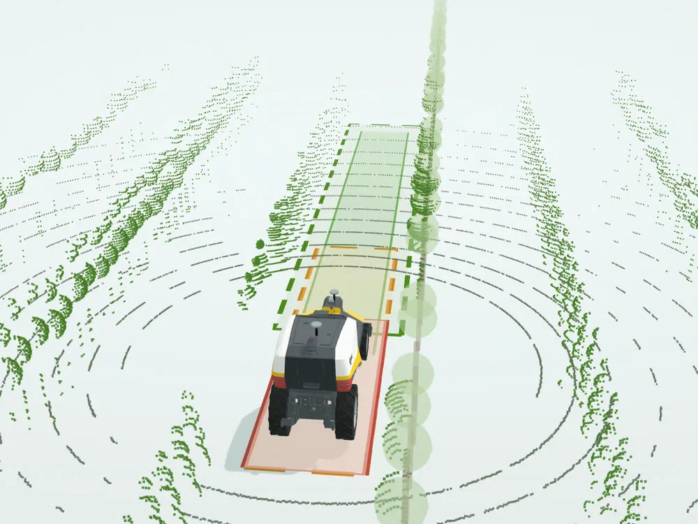
Tree rows: rectangles. As wide as the alley, as long as your machine needs to see ahead. -
03
Sensors That Know Their Limits
Camera and LiDAR see differently: the camera sees colour and detail, the LiDAR measures distance, by day and by night. When light or weather degrade them, the FAOS notices. Here fog rolls into a tree row and the view shrinks: your machine slows down to match what it can still see, and stops safely until the view clears.
A LiDAR point cloud of CARO in a tree row, with rectangular zones and the camera's view above. Fog rolls in, the visible range shrinks and fog clutter fills the point cloud; the machine slows down, then comes to a safety stop and waits until the view clears. -
04
One Model for Both Sensors
One deep learning model has a branch for each sensor: an image branch for the camera and a point cloud branch for the LiDAR. Together they make a single semantic segmentation of the scene, telling terrain, vegetation, people and objects apart.
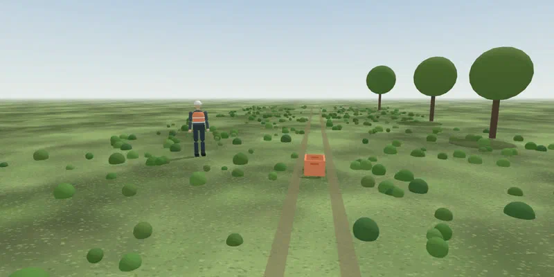
Camera 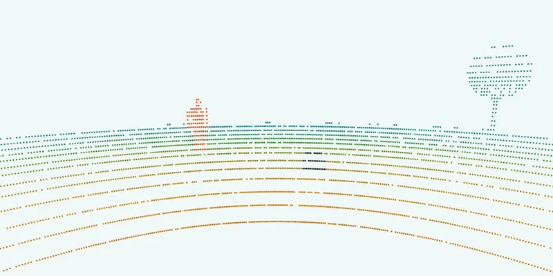
LiDAR -
05
From Detection to Decision
From the segmentation, perception reports what it found. Navigation decides what to do about it, and a separate safety layer stands behind both.
- Perception Forwards the class, position and distance of every object, and how far it can currently see.
- Navigation Depending on the use case, drives around an obstacle or stops. For a person in the warning zone, or a view too short for its speed, it slows down and stops.
- Certified safety layer Has its own sensors and stops your machine as soon as anything reaches the hazard zone, even if perception has missed it.
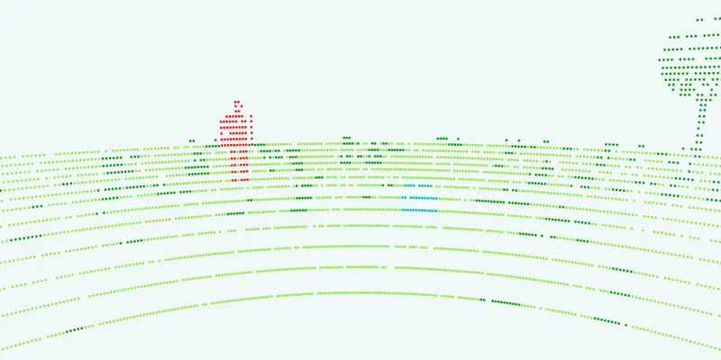
Segmented: terrain, vegetation, person, object 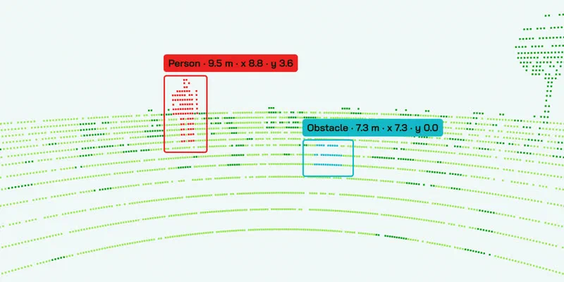
Forwarded: class, distance and position -
06
Already Following People in Real Data
This is our model’s output on real LiDAR data from a Lero.03 test drive. It picks out a person and follows them as the machine approaches, from about 8 m to under 4 m, while it segments the terrain, vegetation, buildings and fences around them. Early person detection shows good results, and the model keeps learning from every new drive.
Real data · Lero.03 test drive
A real LiDAR recording from a Lero.03 test drive, seen from above and from the side. A person is detected, boxed and followed with their distance as the robot approaches, among terrain, vegetation, buildings and fences, each in its own colour.